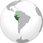
Ngokweenkcukacha:Republic of Peru 1824- 1836 (orthographic proyection).JPG
Appearance

Size of this preview: 600 × 600 pixels. Other resolutions: 240 × 240 pixels | 480 × 480 pixels | 768 × 768 pixels | 1 024 × 1 024 pixels | 2 000 × 2 000 pixels.
Original file (2 000 × 2 000 pixels, file size: 243 KB, MIME type: image/jpeg)
File history
Click on a date/time to view the file as it appeared at that time.
| Umhla/ixesha | Thumbnail | Dimensions | User | Khawuphawule | |
|---|---|---|---|---|---|
| Ngoku | 16:22, 8 EyeSilimela 2020 |  | 2 000 × 2 000 (243 KB) | Marcomogollon | Faltó el territorio del Caquetá |
| 16:06, 8 EyeSilimela 2020 |  | 2 000 × 2 000 (241 KB) | Marcomogollon | Agrego los territorios disputados con la Gran Colombia | |
| 12:57, 29 EkaTshazimpuzi 2018 |  | 2 000 × 2 000 (471 KB) | Janitoalevic | Better quality | |
| 21:30, 17 Eye Nkanga 2010 |  | 500 × 500 (22 KB) | Traleo | {{Information |Description={{en|Location of the Viceroyalty of Peru in orthographic projection, approx. 1796. {{legend|DarkGreen|Sovereign territory.}} {{legend|Lime|Territories claimed by the Captaincy General of Chile.}}}} |
Ukusetyenziswa kwale file
Akukho maphepha asebenzisa ezi nkcukacha


