
File:Map of Mpumalanga with Dipaleseng highlighted (2011).svg

Size of this PNG preview of this SVG file: 617 × 599 pixels. Other resolutions: 247 × 240 pixels | 494 × 480 pixels | 791 × 768 pixels | 1 054 × 1 024 pixels | 2 108 × 2 048 pixels | 768 × 746 pixels.
Original file (SVG file, nominally 768 × 746 pixels, file size: 253 KB)
.svg)
Isishwankathelo
| Inkcazo |
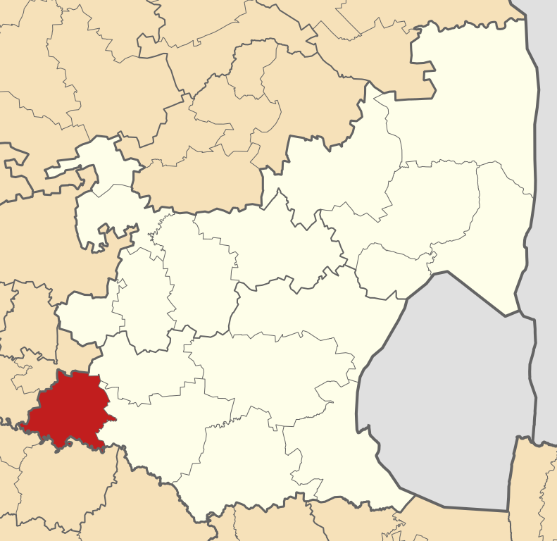
English: Map of municipal boundaries in Mpumalanga, as they will be after the municipal elections of 18 May 2011, with the Dipaleseng Local Municipality highlighted in red. Based on File:Map of Mpumalanga with municipalities blank (2011).svg. |
| Umhla | |
| Imvelaphi | Own work |
| Umbhali | Htonl |
.svg)
ukunika imvume
I, the copyright holder of this work, hereby publish it under the following licenses:

|
Permission is granted to copy, distribute and/or modify this document under the terms of the GNU Free Documentation License, Version 1.2 or any later version published by the Free Software Foundation; with no Invariant Sections, no Front-Cover Texts, and no Back-Cover Texts. A copy of the license is included in the section entitled GNU Free Documentation License. |
This file is licensed under the Creative Commons Attribution-Share Alike 4.0 International, 3.0 Unported, 2.5 Generic, 2.0 Generic and 1.0 Generic license.
- Khululeka/ukhululekile
- Yabelana nabanye – to copy, distribute and transmit the work
- to remix – to adapt the work
- Phantsi kwezi meko zilandelayo
- attribution – You must give appropriate credit, provide a link to the license, and indicate if changes were made. You may do so in any reasonable manner, but not in any way that suggests the licensor endorses you or your use.
- share alike – If you remix, transform, or build upon the material, you must distribute your contributions under the same or compatible license as the original.
You may select the license of your choice.
File history
Click on a date/time to view the file as it appeared at that time.
| Umhla/ixesha | Thumbnail | Dimensions | User | Khawuphawule | |
|---|---|---|---|---|---|
| Ngoku | 02:16, 14 Inyanga kaCanz... 2011 | | 768 × 746 (253 KB) | Htonl | == Summary == {{Information |Description ={{en|1=Map of municipal boundaries in w:Mpumalanga, as they will be after the municipal elections of 18 May 2011, with the w:Dipaleseng Local Municipality |
Ukusetyenziswa kwale file
The following page uses this file:
Global file usage
The following other wikis use this file:
- Usage on en.wikipedia.org
- Usage on ha.wikipedia.org
- Usage on ig.wikipedia.org
- Usage on pl.wikipedia.org
- Usage on ru.wikipedia.org
- Usage on sw.wikipedia.org
- Usage on ts.wikipedia.org
- Usage on www.wikidata.org
- Usage on yo.wikipedia.org
- Usage on zu.wikipedia.org
.svg)